Introduction
Wetlands are vital ecosystems that provide habitat for many species and deliver important services such as flood regulation, carbon storage, and biodiversity support. Doñana National Park in Spain has faced years of drought, followed by periods of heavy rainfall and flooding. These changes have significantly affected the vegetation and wildlife of the park.
Objective
This project aimed to monitor how vegetation in Doñana National Park responds to drought and flooding using satellite-based vegetation and water indices.
Method
- Data source: Sentinel-2 satellite imagery.
- Indices used:
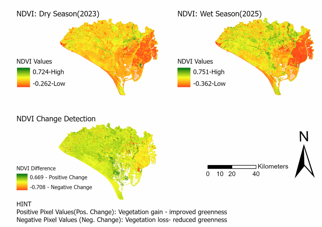
- NDVI (Normalized Difference Vegetation Index): to assess vegetation health.
- MNDWI (Modified Normalized Difference Water Index): to identify open water areas.
- Images from both dry and wet seasons were analyzed to detect changes in vegetation cover.
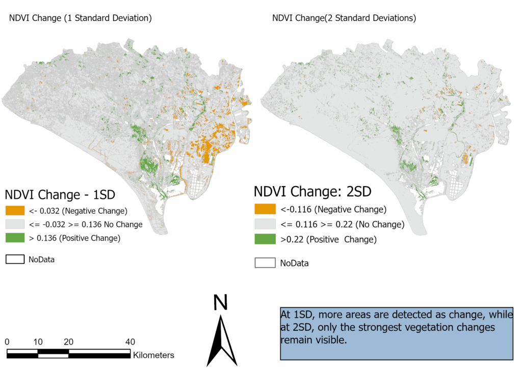
- Change detection was performed to classify areas with increased vegetation, decreased vegetation, or no change.
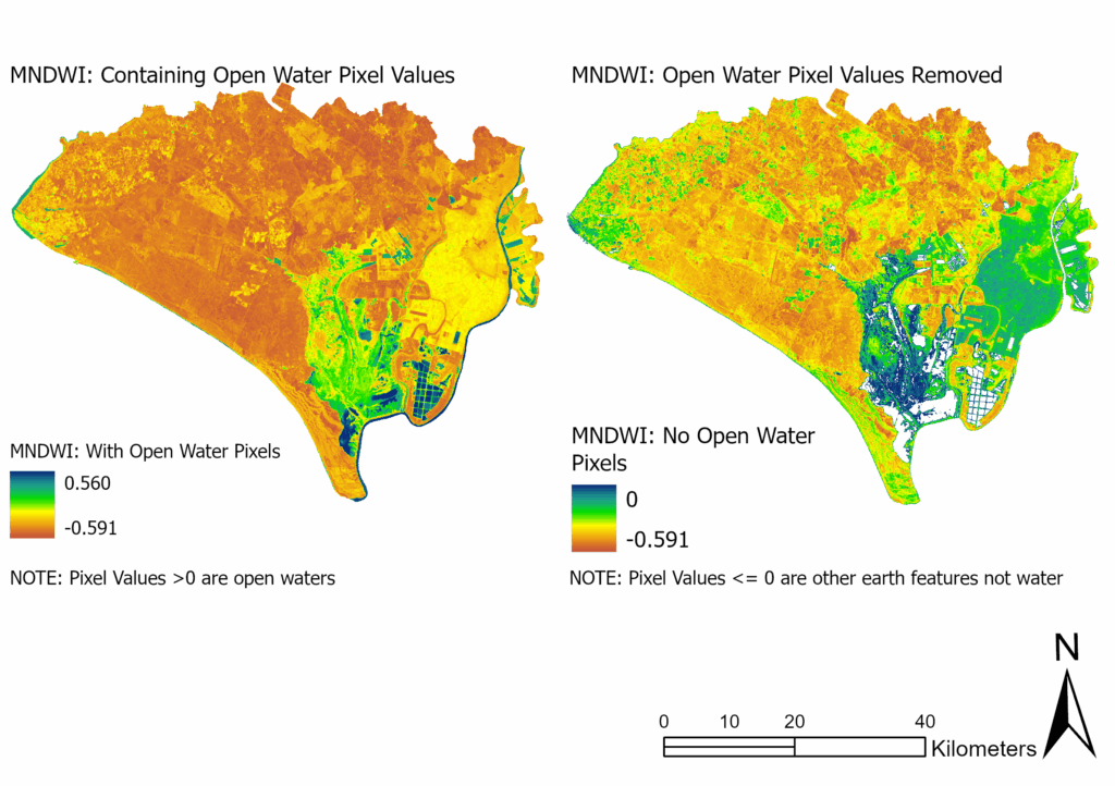
Figure 2: Modified Normalized Difference Water Index (MNDWI)
Results
- During the wet season, vegetation cover improved significantly across the park.
- About 2–11% of the area showed increased greenness, depending on the threshold applied.
- Only a small portion of the area showed vegetation decline after flooding.
- Threshold choice (1SD vs. 2SD) influenced how much change was detected:
- 1SD captured subtle changes.
- 2SD captured only the most significant changes.
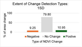
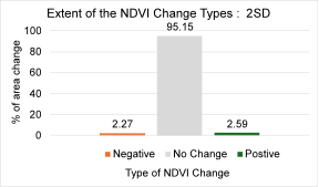
Figure 5: Area Change (%) with 1SD (Left) and 2SD (right)
Conclusion
This study demonstrates how remote sensing and vegetation indices can track wetland changes over time. The findings highlight that:
- Flooding generally restores vegetation health in Doñana National Park.
- Careful threshold selection is important in interpreting vegetation dynamics.
- Satellite-based monitoring provides valuable insights for wetland management and conservation planning.